
The usefulness of "escape maps," which have been applied from building disaster prevention planning to evacuation planning during disasters.
SCROLL DOWN
The Great East Japan Earthquake drastically changed people's awareness of disasters. It was reaffirmed that the seismic resistance of buildings themselves can sometimes be overwhelmed by the immense forces of nature. At the same time, the importance of evacuating to a safe place quickly during a disaster was reaffirmed.
The "Evacuation Map," created by volunteers at Nikken Sekkei, is a tool for visualizing evacuation routes on a map during disasters. By allowing residents to create evacuation routes themselves in the simplest possible way, taking into consideration children and the elderly who are more likely to be delayed during evacuation, it has become increasingly effective in fostering a sense of personal responsibility for disasters, and is beginning to spread to many communities.
By using an evacuation map, you can simulate and prepare for unforeseen circumstances. We'll introduce the features and tips for using evacuation maps to help you live your daily life with greater peace of mind.



What is an escape map?
"Evacuation Map" is a method developed by volunteers at Nikken Sekkei that visualizes evacuation times on a map.
Large-scale buildings are designed to allow for the quickest possible evacuation during disasters. This concept has now been extended to the city and urban levels.
This is an idea that could only come from Nikken Sekkei, a company that often designs large-scale buildings.
How do you make an escape map?
Creating an evacuation map is very simple. Color-code the paths on the map in 3-minute intervals (within 3 minutes, 3-6 minutes, 6-9 minutes, 9-12 minutes, 12-15 minutes, 15-18 minutes, 18-21 minutes, 21-24 minutes) to show how long it would take an elderly person to reach an evacuation site walking slowly (43m per minute).
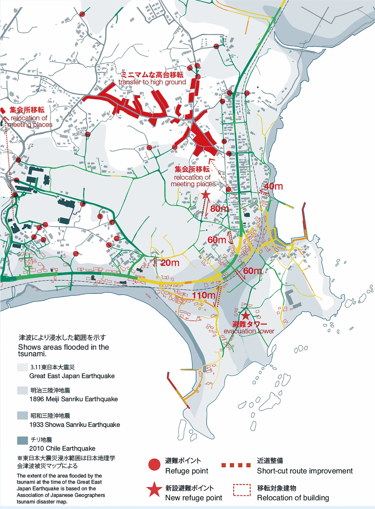
Earthquakes cause more than just building collapses and tsunamis. Evacuation maps can be tailored to reflect the specific characteristics of each region. For example, workshops in Shimoda City and Kawazu Town in Shizuoka Prefecture, both located near the sea, considered a combined disaster involving tsunamis and landslides. In the Kuna district of Chichibu City, surrounded by mountains, an evacuation map was created to protect against landslides.
What are the benefits of creating an "escape map" through a workshop?
By discussing ideas—such as where to build new roads or evacuation towers needed to shorten evacuation times—participants can propose their own plans for building a disaster-resilient community. Furthermore, when people of all ages and genders living in the area come together to communicate, they can share insights into risks that might be overlooked by any single generation or gender.
By exchanging opinions across generations and professions—including volunteer firefighters, local residents, children, and adults—these workshops also serve as a communication tool for building a cooperative framework in emergencies.
Incidentally, at the workshop held in the Hirota-cho district of Rikuzentakata City, the first session was attended primarily by middle school students, who created an evacuation map. The second session was attended mainly by volunteer firefighters, who added details and made corrections to the map created by the students.Furthermore, during the third session, members of the fishing cooperative’s women’s division took the lead, adding evacuation challenges and points to note from a woman’s perspective to the evacuation map. For some people, this process reveals routes they would never have considered in their daily lives. In this way, evacuation plans are developed that incorporate the practical, firsthand knowledge of each individual who knows the town well.
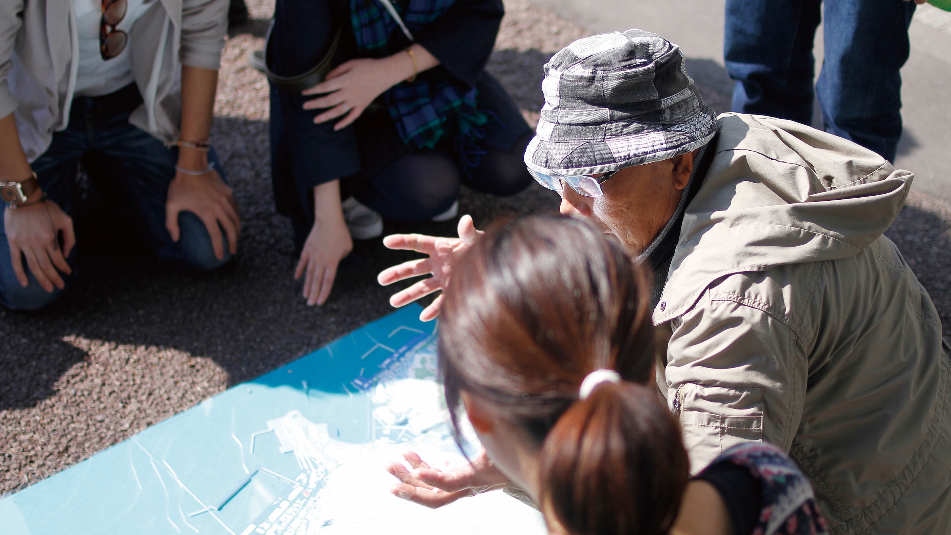
From workshops to fieldwork: Evacuation plans that are useful in emergencies, incorporating physical sensations.
After a workshop where participants share their opinions and review evacuation plans, they acquire the literacy needed to escape. Building on this, they conduct evacuation drills in the field and reflect on the experience, developing practical evacuation plans that they can use to act in an emergency.
The "escape map" is spreading far and wide, beyond the control of the members who devised it.
Furthermore, by programming the mechanism of the evacuation map, it can be shared on the internet. Sharing it online will gather more ideas about new routes and locations for evacuation towers. Software has also been developed to perform simulations to verify the consistency of what has been created. While maintaining consistency, data from more people will be accumulated, and it has the potential to spread from local to all of Japan. As the evacuation map has spread, its achievements have been recognized, and the Yamamoto Laboratory of Meiji University, the Kinoshita Laboratory of Chiba University, and the Nikken Sekkei Volunteer Club, who were involved in holding evacuation map creation workshops, jointly received the Architectural Institute of Japan Award in 2018. Their award was given for "Promoting intergenerational and inter-regional risk communication through evacuation map creation," for leading to disaster prevention town planning centered on local residents, and for attracting the interest of a wide range of people and broadening the base of local disaster prevention efforts.
The "Escape Map," originally created by volunteers at Nikken Sekkei from their architectural disaster prevention planning, has gained recognition for its practicality. As a result, it has gradually expanded beyond the initial members' control, and requests for workshops have been pouring in from all over Japan, with people saying, "We want to make one too!" and "We want you to hold a workshop!" It has also attracted attention from experts in maps and disaster prevention. From the perspective of "creating cities that protect lives," the "Escape Map" initiative continues to spread throughout Japan.